.jpg)
Water scarcity is an emerging threat to food security and socio-economic prosperity, and it is crucial to assess crop production response to water scarcity in large river basins. The water footprint, which considers water use in supply chains, provides a powerful tool for assessing the contributions of water resources within a certain region by tracking the volume and structure of virtual water flows. In this study of the structure of the water footprint network from a complexity perspective, we reassessed the significance of water resources for crop services in a large river basin with a severe water shortage -the Yellow River Basin (YRB) of China. The temporal increase of the complexity index indicated that the Virtual Water out-Flows (VWF) from the YRB were becoming increasingly critical to China; i.e., the ability of YRB to produce crops boosted the difficulty of its water being replaced by water exporting from other basins. Decomposition of complexity suggested that during the 1980s to 2000s, the temporally increased complexity was due mainly to the lack of competitors and the increasing uniqueness of crops supporting VWF. This complexity deeply embedded the YRB into the footprints of a water network that facilitated further development with constrained water resources. Still, it also reinforced the reliance of other regions on YRB's scarce water. Based on this analysis, we suggest that resource regulation should be carried out appropriately to ensure ecological sustainability and high-quality development of river basins.
In this study, we took a complex perspective concerning water footprint networks and assessed the significance of the YRB to China's crop supply. Our results showed that although the YRB had reduced its virtual water out-flow because of resource constraints, its importance to crop production in China increased when considering water footprint networks. The complexity of the water footprint network enabled our approach to provide a new perspective for understanding the changes in the status of a basin with a severe water shortage concerning national crop production.
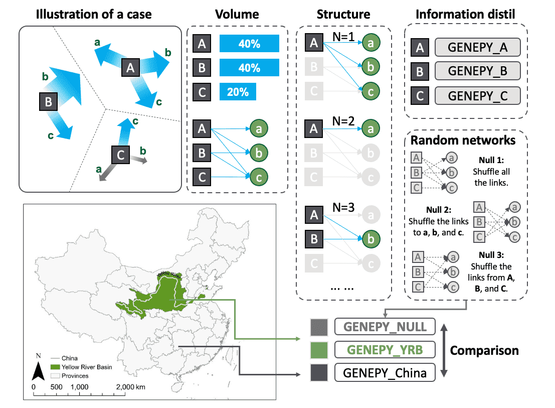
Virtual water transfers between regions through multiple dominant crops. When the proportion of VWF from a region is large enough when considering a specific crop, we establish a connection between the region and the crop. In that way, we abstract region-crop bipartite networks for analysis. Here, we give a more straightforward illustration of our method: (1) Illustrating a nation comprised of three regions (
Accepted research on Hydrology and Earth System Sciences (HESS):
Follow my latest research on ResearchGate Follow updates on my website